





Intro
Universal Transverse Mercator (UTM) is a projected coordinate system used to represent locations on Earth with 2D Cartesian coordinates: Easting (X) and Northing (Y), measured in meters.
UTM divides the Earth into 60 longitudinal zones spaced 6 degrees apart. Zone 1 covers longitude 180° to 174° W; zone numbering increases eastward to zone 60, which covers longitude 174°E to 180°.
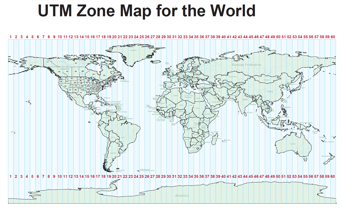
Each zone projects locations onto a local Cartesian grid, allowing distances and positions to be measured in meters with relatively low distortion. The central meridian of each zone is assigned a false easting of 500,000 m, ensuring all Easting values within the zone are positive.
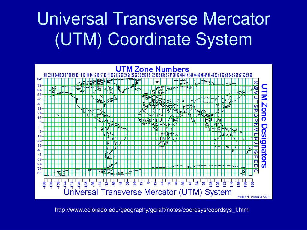
Because UTM uses meters on a local Cartesian grid, it is much easier to compute distances, headings, and robot Poses than using the Geodetic Coordinate System (latitude and longitude) directly.
Example UTM Coordinate
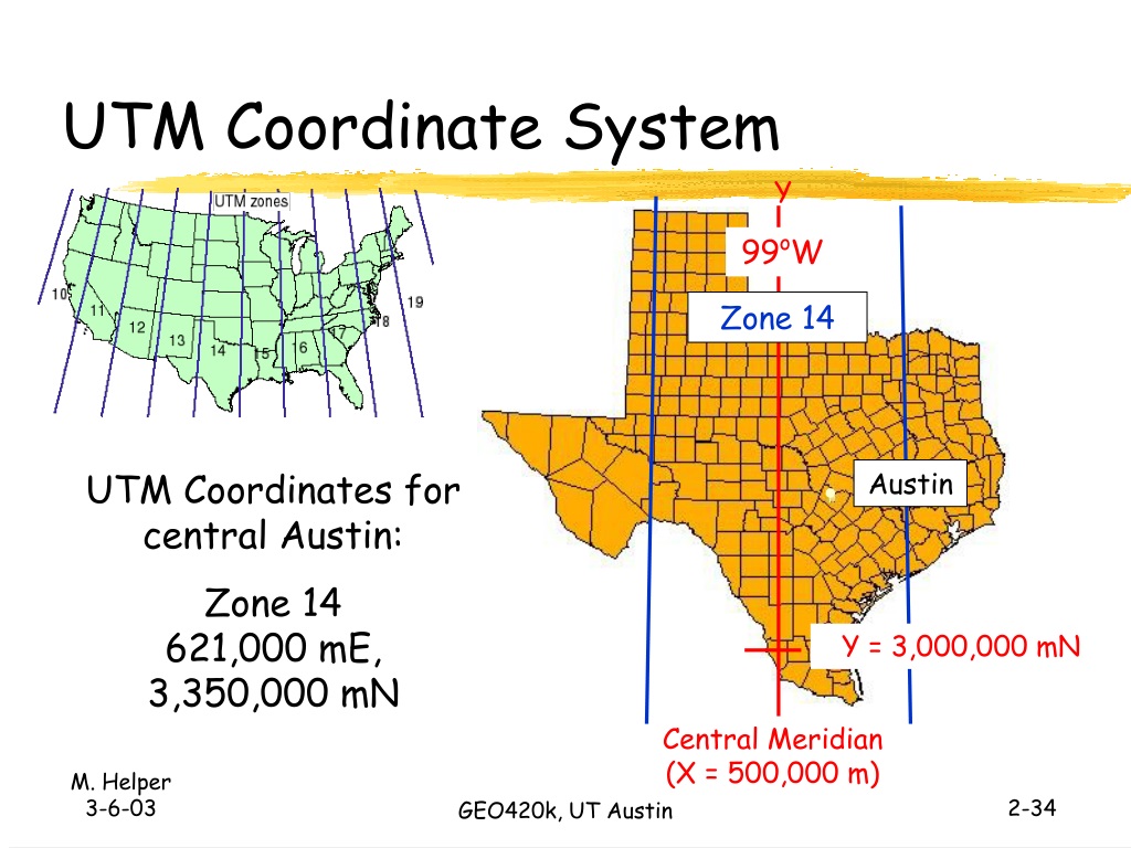
Austin is approximately 121 km east of the central meridian, so its UTM coordinate might be
Zone 14
621,000 mE (500,000 m + 121,000 m)
3,350,000 mN (3,350 km north of the equator)